Military Vehicle Trust D-Day 2024

  • Home
  • Normandy
    • The History and Geography of Normandy
  • DDAY 6th June 1944
    • D-Day as it happened
    • Beyond the Beaches
    • Commemorating D-Day
    • Personal Stories >
      • Research Tips
      • Citizens of Vierville-sur-Mer
      • John Robson: Mine Clearance
      • William Jowitt: Phantom GHQ Liaison Regmt
      • Wright and Moore 101st medics
      • Dickie Harrap and the 13th/18th Hussars
  • Planning a trip to Normandy
    • Exclusive Ferry Discount
    • Places to Visit >
      • Interactive Map
      • Museums >
        • Musee Memorial Pegasus
        • Musee Airborne
        • Overlord Museum
        • Deadman’s Corner/DDay Experience
        • Douvres Radar Museum
        • DDay WINGS Museum
        • Liberators Musee
        • Utah Beach Museum
        • DDAY Collins Museum
        • Le Grand Bunker
        • Caen Memorial Museum
        • Big Red One Museum
        • Musée de la bataille de Tilly-sur-Seulles
        • Normandy Victory Museum
        • DDAY OMAHA Museum
        • Chateau Cruelly
        • Arromanches360
        • Museum of La Percée du Bocage
        • Omaha Beach Memorial Museum
        • World War II Museum – Quineville
        • Memorial Museum of the Battle of Normandy
        • Musée des épaves sous-marine
        • Juno Beach Museum
        • Gold Beach Museum
        • Museum of the Bloody Gulch
      • Batteries and Strongpoints >
        • Batterie D'Azeville
        • Batterie Longues-Sur-Mer
        • Batteries de Crisbecq
        • Maisy Battery
        • Merville Battery
        • Pointe Du Hoc
        • Brecourt Manor
        • Holdy Battery
        • Widerstandsnest WN60
        • Widerstandsnest WN62
      • Cemeteries >
        • American Cemetery
        • Bayeux War Cemetery
        • Ryes War Cemetery
        • Beny-sur-Mer Canadian
        • La Cambe German Cemetery
      • Memorials >
        • Hill 112 Memorial
        • Thomas Meehan Memorial
        • The Richard D. Winters Memorial
      • Church at Sainte Mere Eglise
      • Church at Angoville au Plain
      • Liberty Way
      • Non-WW2 places to visit
      • Normandy in Four Days
    • Taking Your Vehicle to France >
      • Compulsory Documentation and Equipment
      • Driving in France
      • Fuel
      • Towing a Trailer in France
      • Vehicles over 3.5 tonnes
      • Armoured Vehicles
      • Spare parts and tools
      • Assistance
    • Getting There
    • Passport and GHIC cards
    • ETIAS Travel Permit
    • Accommodation
    • Local Information
    • In an Emergency
    • Books, Films and Apps
  • MVTDDAY24
  • Previous Visits
    • 2019
    • 2014
  • Shop
    • D-Day merchandise
  • Contact

The History and Geography of Normandy

Geography

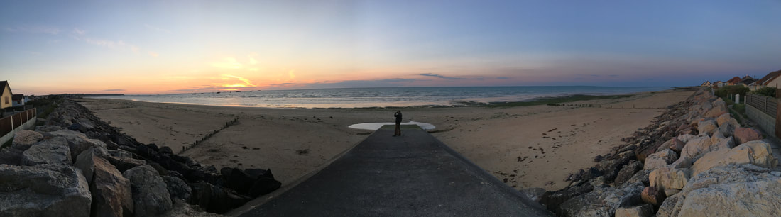
The western part of Normandy is the home of the DDay landing beaches (the green shaded area on the map)  and is  situated on  metamorphic rock that was lifted up and eroded into its characteristic plateau “peneplain” landscape inland and granite cliffs along the coast. The remaining area is part of the large Paris Basin containing the River Seine which meanders down to its estuary, cutting into limestone bedrock and creating coastal cliffs.  There are also long stretches of beach along the eastern coast.
​
Much of Normandy is made up of flat grasslands and farmlands interspersed by gentle hills and the hedges (the bocage) that edge the fields. Just 12.8% of the region is woodland. Agriculture is highly diversified, ranging from the large cereal farms to the dairying and horse-rearing activities of the Pays d’Auge and the intensive market gardens of the west.

Historic Normandy

The region has a rich history spanning the millennia from pre-historic times to the Second World War and beyond, with many Roman, Medieval treasures in between.

Pre-historic archaeological
discoveries, such as cave paintings, prove that humans were living in Normandy in prehistoric times. The Seine and Eure valleys were inhabited in Paleolithic times, by the Celts (also known as the Gauls), who invaded the area in waves, from the 400 BC. 

In 56 BC, Julius Caesar seized the area and it became part of the Roman Province of Gallia Lugdunensis. Normandy became prosperous during the Roman occupation and evidence of roads, villas and theatres have been discovered.
 
In the late 3rd century AD, Saxon pirates raided coastal settlements in Normandy.
As his empire declined, Viking fleets of “Norsemen” began to raid the Seine Valley by attacking and destroying monasteries thus filling the power vacuum left by Charlemagne.
The Fiefdom of Normandy created for the Viking leader Hrólfr Ragnvaldsson or Rollo. The name "Normandy" reflects his  "Norseman" origins and as his descendants intermarried and adopted Christianity, they became the Normans. They were typically a Norman French-speaking mixture of Viking and indigenous Franks, Celts and Romans. The architectural heritage from this period is rich and widespread -and especially evident in Norman churches and cathedrals.
Rollo's descendant William who was born at Chateau de Falaise in Normandy, became “William the Conqueror” who defeated the last of the Anglo-Saxon English kings, King Harold (Godwinson), at the Battle of Hastings in 1066. He, of course, became King of England. The Bayeux Tapestry, which can be visited in Bayeux, is an embroidery that records the Norman Conquest of Britain and provides a unique insight into civil and military life at that time. William ruled as both Duke of Normandy and King of England, so the two areas were linked. The Normans also conquered as far as Southern Italy and the Canary Islands and joined the Crusades occupying states of Asia Minor and the Holy Land, making them a significant power. 
William ruled as both Duke of Normandy and King of England, so the two areas were linked. The Normans also conquered as far as Southern Italy and the Canary Islands and joined the Crusades occupying states of Asia Minor and the Holy Land, making them a significant power.  The architectural heritage from this period is rich and widespread -and especially evident in Norman churches and cathedrals.
In 1204, during the reign of King John, mainland Normandy was taken from England by King Philip II of France, but Normandy was occupied by English forces during the Hundred Years' War in 1345–1360 and again in 1415–1450. Joan of Arc, a peasant girl famously led the French army to victory over the English at Orléans in 1429.  She was captured and handed over to the English who eventually burned her at the stake in Rouen in 1431.
Although Normandy was an important agricultural area, industries such as weaving, metallurgy, ceramics, and shipbuilding were introduced and developed. Normans also expanded business abroad, in North America. Samuel de Champlain left the port of Honfleur in 1604 to cross the Atlantic Ocean and found Acadia in north-east America. He later founded the City of Québec.

Norman life changed little despite the huge political upheavals in France at this time. In the 1780s, the economic and political crisis that resulted in the French Revolution was followed by an economic revival that saw the mechanisation of local textile manufacturing and the introduction of the first trains.
 
With the advent of fashionable seaside tourism in the 19th century, came the first beach resorts and Normandy prospered.

During the Second World War, Normandy was part of the German occupied zone of France and was fortified as part of the Atlantic Wall. It was the location of the unsuccessful Dieppe Raid by Canadian and British armed forces as well as the decisive allied D-day landings “Operation Overlord” ,which began the Invasion of Normandy in 1944 and led to the liberation of Europe. The Channel Islands which were occupied from 30 June 1940, were only liberated only on 9 May 1945 at the end of the war.
Find out more about D-Day
Beyond the Beachhead
D-Day Commemorations

Modern Day Normandy

Normandy still retains a very rural character, with its scenic flat farmlands and gentle rolling hills. Agriculture employs fewer people than in previous centuries, but is highly diversified, ranging from large cereal farms to dairying and horse-rearing activities.
 
The population of  present-day Normandy is 3,500,000 and is concentrated around Rouen and Le Havre or in the urban centres such as Caen, Cherbourg, and Alençon. Some traditional industries such as textiles have declined but, but activities like oil refining, petrochemicals closer to Paris and a range of mechanical and electrical engineering industries (including vehicle manufacture) have increased and have taken over as the main employers. Rouen and Caen are the principal administrative and commercial centres.
Picture
In 2016, the Basse-Normandie région (Upper Normandy) was joined with the région of Haute-Normandie (Lower Normandy) to form the new administrative entity of Normandy. It is a renowned tourist destination, for both domestic and foreign visitors with tourism accounting for 5.7% of Normandy’s GDP – Remembrance Tourism connected to the 100 plus WW2 sites and attractions, accounts for over 6 million visits a year.
Home
Military Vehicle Trust
Normandy
​History & Geography
DDay
The D-Day Landings
​Commemorating D-Day


Planning Your Trip
Getting There
Accommodation
Local Information
Taking Your Vehicle
Driving in France
Assistance


Interactive Map
Places to Visit

Essential Reading


Previous Visits
2019 : 2014

​Shop
​Contact Us


Address:
PO Box 1712,
Northampton, NN2 1LQ


The MVT is a registered company No: 02226906
​Registered under the Charities Act 1960 No. 327768
If you require any  assistance with accessing this website or would like a document in a more accessible format,  please contact us here
©The Military Vehicle Trust 2023   |   Cookie Policy   |   Privacy Policy
Site by Treble3